C-GEO versions

Collect data from geodetic instruments and visualize, edit it via CAD mapping
8.8
Oct 27, 2021
8.7
Feb 14, 2014
8.6
Feb 26, 2013
8.5
Feb 6, 2012
Review
8.4
Jan 29, 2011
8.3
Jan 24, 2010
8.2
Jan 19, 2009
8.1
Aug 25, 2008
8.0
Nov 30, 2008
7.0
Apr 16, 2008
Editorial review
rating
6.0
Nov 18, 2008

Alternative downloads

VeryPDF Raster to Vector
rating

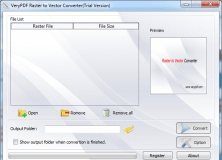
Raster to Vector Converter is used to convert raster files to vector files.

GEO Spider
GEO Spider
rating

It can analyze and trace all network applications on the fly

Geo.De.Sy
Geo.De.Sy
Free
rating

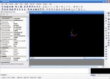
Complete drawing environment with survey utilities.

Survey Import and Export
rating

The Survey Import and Export program works with AutoCAD.

Geo-Segregation Analyzer
Free
rating

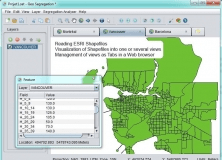
An open-source program that can read ESRI Shapefiles.